

Deep beneath the surface of Mars, China’s Zhurong rover has discovered evidence of two significant floods that likely sculpted the area it has been exploring since it landed in May 2021.
The first outcome from Zhurong‘s radar imager, which can probe up to one hundred meters below the surface, involved a study that was published in Nature Today.
Svein-Erik Hamran, a planetary scientist at the University of Oslo, examined the only ground-penetrating radar data ever obtained from the planet gathered by NASA’s Perseverance Rover.
“It is a very interesting paper,” Hamran said, “and I was particularly impressed by how deep they can see with this radar.”
In the past, scientists have been baffled by Zhurong’s landing site, which was on the huge plains of Utopia Planitia in Mars’ northern hemisphere. Some people have speculated that the landscape previously included water or ice. Sedimentary layers found in the area, along with geological features like scarred cones, show that it was either an old ocean or the site of massive floods, according to observations from space.
Infrared Photographs of Landing Site Taken by China’s Tianwen-1 Mars Spacecraft
Researchers discovered hydrated minerals in May after analyzing infrared photographs of the landing site taken by China‘s Tianwen-1 Mars spacecraft. These minerals may have developed when groundwater peaked through the rock or ice.
However, it’s also possible that the area was covered in lava, which would have hidden some of these hydrological activities beneath the surface. As has been seen in other areas of the Utopia basin, eruptions from the volcano Elysium Mons to the east of the landing site or other volcanic activity may have blanketed the area in magma. Researchers want to know what happened and whether water or ice could still be hiding beneath the rocks by analyzing the radar data.
Planetary scientist Liu Yang of the National Space Science Center in Beijing, a research co-author, said, “We want to know what is going on beneath the surface.”
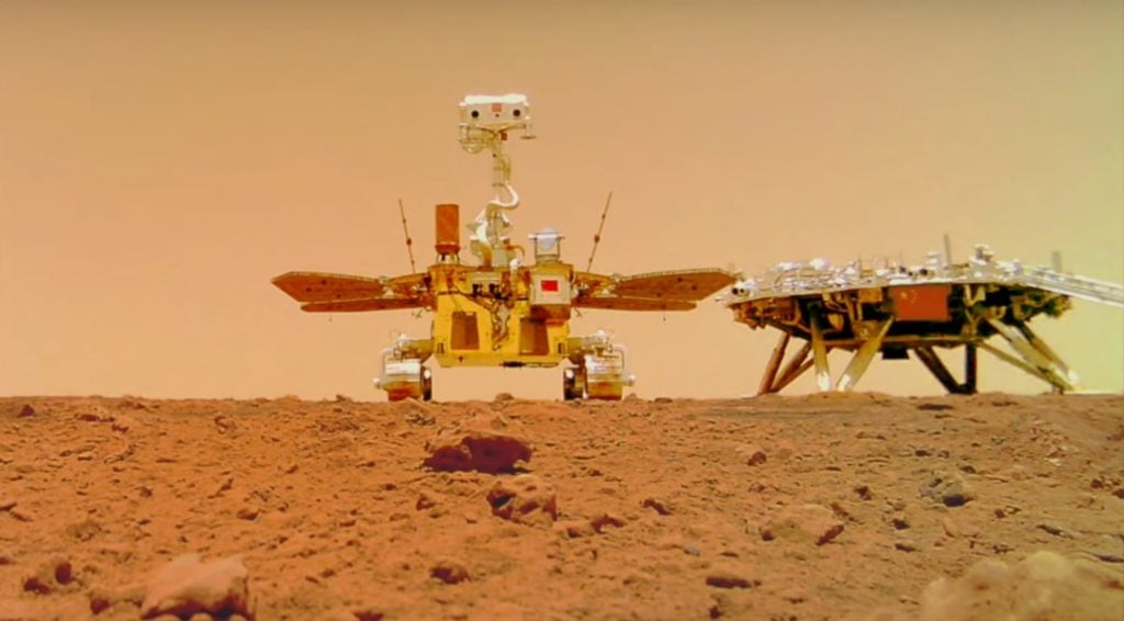
The southern region of Utopia Planitia has been the focus of Zhurong, China’s first rover on Mars. The rover’s ground-penetrating radar transmits high-frequency radio waves that can penetrate the surface to a depth of between 3 and 10 metres, and low-frequency waves that can reach up to 100 metres underground but offer poorer resolution.
The study’s authors examined low-frequency data collected from Zhurong as it traveled south of its landing site between May 25th and September 6th across a distance of more than 1,100 meters. The refraction of radar signals by subsurface materials reveals the size of their grains and their capacity to store electric charge. Usually, stronger signals denote larger items.
The radar detected two horizontal strata with intriguing patterns, but it did not identify any signs of liquid water below eighty meters. The scientists found that in a layer between ten and thirty meters deep, the strength of the reflected signals increased with depth.
The scientists claim that this is most likely brought on by larger stones resting at the base of the layer and smaller boulders building up on top. Between thirty and eighty meters down in an earlier, thicker strata, a similar pattern was discernible.
According to co-author Chen Ling, a seismologist at the Institute of Geology and Geophysics, Chinese Academy of Sciences in Beijing, the older layer is likely the result of rapid flooding that transported sediments to the area more than three billion years ago when there was a lot of water activity on Mars.
Upper Layer Possibly Produced By Another Flood
Around 1.6 billion years ago, when there was a lot of glacial activity, the upper layer might have been produced by another flood. The upper layer has a lower capacity to hold an electric charge than would be anticipated for intact volcanic rocks, according to Chen. This makes the presence of intact lava flows implausible. Additionally, contrary to what would be anticipated when lava flows collide with sedimentary material, the researchers did not see any abrupt changes in layering.
However, Chen argues it’s plausible that the top layer was previously covered in a thin coating of lava which eventually disintegrated into smaller fragments. According to Xu Yi, a planetary scientist from Macau University of Science and Technology, radar data alone cannot conclusively determine if a substance is sedimentary or volcanic.
Radar measurements are good at revealing the layering and geometry of subsurface material but not so great at determining its composition, including whether the substance is ice or rock, according to Hamran. In order to create a picture of historical events, he explains, researchers frequently rely on other hints, such as pebbles poking out from the surface. The likelihood that the region has buried saline ice cannot be completely ruled out, according to the authors.
More radar data from the mission is anticipated, including: data collected during Zhurong’s ongoing transit of Mars; findings from the high-frequency radar measurements already made; and Tianwen-1’s orbital radar observations, which observe the planet at great depths. These may be able to shed light on specifics of the terrain, but “this is only the first step,” Ling says.
See all the latest news from Greece and the world at Greekreporter.com. Contact our newsroom to report an update or send your story, photos and videos. Follow GR on Google News and subscribe here to our daily email!
