


Ancient roads shaped the movement of goods, people, and ideas long before modern transportation existed. Many of these routes still cut across the landscape, surviving wars, empires, and centuries of change. They linked early cities, carried traders and soldiers, and supported the rise of powerful kingdoms from the Mediterranean to East Asia.
Researchers say these surviving roads offer rare insight into how ancient societies organized travel, controlled territory, and connected distant cultures. Some date back more than 5,000 years. Others were built by the Romans, Persians, and Khmer Empire as part of vast networks that helped shape world history.
Today, stretches of these historic routes remain visible—or even walkable—allowing travelers to follow the same paths used by ancient people. Here are 15 ancient roads that still exist today.
Royal Road of Knossos, Crete
The Royal Road of Knossos is often described as Europe’s oldest paved road. Built more than 3,500 years ago, it connected the Palace of Knossos with an ancient harbor near modern Heraklion. The palace served as the political and religious center of Minoan life, and the road carried artisans, traders, workers, and ceremonial groups moving in and out of the complex.
Archaeologists uncovered stone paving supported by layers of clay and gravel. A surviving section nearly four meters wide highlights the engineering ability of the Minoans. Visitors can still walk parts of the road and see how people once moved through Bronze Age Crete.
Yuen Tsuen Ancient Trail, Hong Kong

The Yuen Tsuen Ancient Trail once linked the farming villages of Yuen Long and Tsuen Wan. Long before Hong Kong developed modern roads, villagers used it to carry salt, seafood, and produce to coastal markets.
The nine-mile route winds through forests, terraced fields, and steep mountain slopes. It passes the abandoned village of Sheung Chuen, where stilt houses remain as reminders of rural life. The trail is now a popular hiking path and preserves a travel corridor that has existed for nearly a thousand years.
Via Egnatia, Greece, Balkan Peninsula
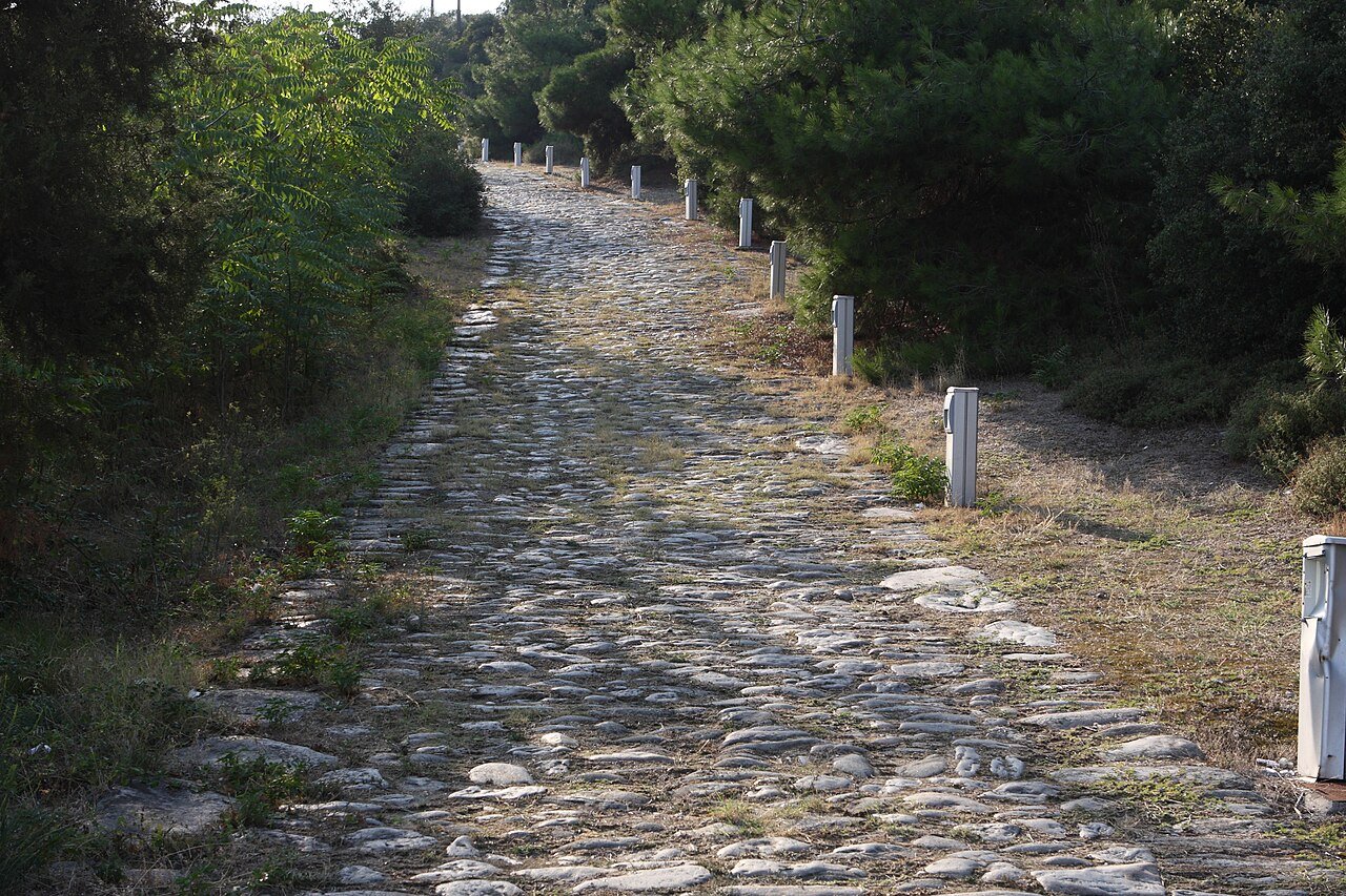
Built more than 2,200 years ago, the Via Egnatia became one of Rome’s most important roads. It stretched 696 miles (1,120 kilometers) from the Adriatic coast to Byzantium, now Istanbul.
It was actually a continuation of Via Appia, one of the earliest and strategically most important roads of the ancient Roman republic which connected Rome with Brindisi.
Roman civilization is well known for its stunning mosaics and marble statues, but it was Rome’s advanced network of roads that allowed this civilization to thrive for centuries.
The Via Egnatia was the first highway to traverse the length of the Balkan Peninsula and the first road built outside of Italy by the Romans.
Roman soldiers, merchants, and officials traveled the route. Goods such as olive oil, wine, ceramics, and metalwork moved across the Balkans. Engineers constructed the road with stone foundations, bridges, forts, and carved milestones.
Sections survive in Albania, North Macedonia, Greece, and Turkey, showing how Rome shaped the region’s movement and trade.
Khmer Highway, Cambodia and Thailand

The Khmer Highway linked Angkor with distant provinces of the Khmer Empire from the 9th to the 15th century. Troops, traders, religious leaders, and messengers traveled across a network designed to hold the empire together.
Raised causeways, stone bridges, rest houses, and water stations lined the route. Many features remain visible today through archaeological surveys and aerial imaging. The road helped spread Khmer culture, language, and religion across Southeast Asia. Near Angkor Wat, travelers can still walk parts of the ancient highway.
Persian Royal Road


The Persian Royal Road formed the main artery of the Achaemenid Empire under Darius the Great about 2,500 years ago. It stretched roughly 1,600 miles (2,600 kilometers) from Susa in Persia to Sardis near the Aegean Sea.
Messengers, merchants, soldiers, and diplomats crossed regions now known as Iran, Iraq, and Turkey. Darius created relay stations with fresh horses that allowed messages to travel quickly across the empire. Herodotus later praised the reliability of these couriers, a description echoed by postal systems centuries later.
Nakasendō Highway, Japan

The Nakasendō, or “Central Mountain Road,” linked Edo (Tokyo) and Kyoto during Japan’s Edo period. The 330-mile (534-kilometer) route passed through mountain valleys instead of the coastal path used by the Tōkaidō.
The Tokugawa shogunate regulated the road’s width, maintenance, and post towns. Seventy-nine stations supported travelers, including samurai, merchants, pilgrims, and feudal lords who followed the mandatory sankin-kōtai system. Preserved stretches in the Kiso Valley still look much as they did more than 200 years ago.
King’s Highway, Jordan

Jordan’s King’s Highway is one of the Middle East’s oldest travel routes. It runs more than 208 miles (330 kilometers) from Irbid to Aqaba. Its earliest roots lie in Bronze Age and Iron Age trade paths that connected desert towns and farming settlements.
The Nabataeans used the route to move incense and spices. The Romans rebuilt it as the Via Traiana Nova, adding forts, towns, and temples. Landmarks along the road include Mount Nebo and Petra, carved into rose-colored cliffs. The highway remains active today and passes landscapes shaped by more than 3,000 years of history.
San Bernardino Pass, Switzerland

The San Bernardino Pass rises more than 6,700 feet (2,000 meters) in the Swiss Alps. Romans likely crossed it, but it became a major trade route in the medieval period. The pass linked northern Italy with central Europe and carried silk, spices, and mail through rugged terrain.
The Order of St. John opened a hospice in the 15th century to shelter travelers during storms. A modern road built in the 19th century improved access, though winter avalanches often closed it. Most traffic now uses a tunnel, while the old pass remains a scenic summer drive.
Camino de Peabiru, South America
The Camino de Peabiru was an Indigenous road network crossing more than 1,900 miles (3,000 kilometers) from Brazil’s Atlantic coast to Peru’s Pacific regions. It predates European arrival and may be thousands of years old.
El Camino Peabiru es un largo sendero precolombino que cruzaba Sudamérica mucho antes de la colonización, conectando la cordillera de los Andes con el Océano Atlántico. Aunque tiene algunas ramificaciones, su recorrido principal consistió en conectar la región donde actualmente… pic.twitter.com/IDuKBGIB3r
— Informa Cosmos (@InformaCosmos) July 18, 2024
Tupi-Guarani peoples and other cultures used it for trade, communication, and spiritual travel tied to the sun god Inti. The road followed natural features—valleys, rivers, and ridges—rather than the engineered style of Roman or Inca roads. Much of the path has been reclaimed by rainforest, but satellite studies have helped archaeologists trace remaining sections.
Via Augusta, Spain

The Via Augusta was the longest Roman road in Hispania. It stretched more than 900 miles (1,500 kilometers) from Cádiz to the Pyrenees. Built under Emperor Augustus in the 1st century BC, it helped the Roman army move across the peninsula and strengthened control over the region.
Engineers paved the road and added bridges, culverts, and milestones carved with Latin inscriptions. Modern highways, including the A-7, follow parts of its route. Surviving Roman bridges and milestones still stand across Spain.
Silk Road

The Silk Road was a network of trade routes linking China to the Mediterranean from the 2nd century BC to the 14th century AD. It shaped global commerce and cultural exchange for more than a thousand years.
Silk, spices, porcelain, metals, and horses crossed deserts, mountains, and grasslands. Buddhism, Islam, and other religions spread along the same paths. Technologies such as papermaking and gunpowder moved west.
Cities including Samarkand, Kashgar, and Merv became major trading and cultural centers. The route declined as sea trade expanded, but its influence remained.
The Ridgeway, Britain

The Ridgeway in southern England has been used for at least 5,000 years. The 87-mile (140-kilometer) trail runs from Overton Hill in Wiltshire to Ivinghoe Beacon in Buckinghamshire.
Prehistoric communities used their high chalk ridges as a safe, dry route for moving livestock and goods. The path passes sites such as the Uffington White Horse and several Iron Age hillforts. Recognized as a National Trail in 1972, it remains one of Britain’s most historic walking routes.
Road to Giza, Egypt

The road leading to the Giza Plateau has been in use for at least 4,500 years. During Egypt’s Fourth Dynasty, it served as a ceremonial causeway aligned with celestial events. Pharaohs traveled along the route during funerary processions to the Great Pyramid, Khafre’s Pyramid, Menkaure’s Pyramid, and the Sphinx.
Workers carried limestone blocks and granite along the same path. Priests performed rituals, and crowds gathered to witness royal ceremonies. Today, the road is paved and guides visitors past the same monuments ancient Egyptians approached millennia ago.
King’s Highway, United States

England’s King Charles II ordered the construction of the King’s Highway in the late 1600s. The road ran about 1,300 miles (2,100 kilometers) from Charleston, South Carolina, to Boston, Massachusetts.
It linked colonial towns and carried goods, letters, and political ideas up and down the Eastern Seaboard. Later, parts of the highway became sections of U.S. Route 1. Today, preserved stretches offer a look at everyday American travel before independence.
Old Great North Road, Australia

#/media/File:Convict-built_road,_Great_North_Road,_NSW.jpg)
The Old Great North Road was built between 1825 and 1836 by convicts in New South Wales. It ran 162 miles (260 kilometers) from Sydney to the Hunter Valley. Workers cut through thick bushland and built stone walls, culverts, and bridges by hand, often while chained.
The road opened new land for settlement and farming. Several preserved sections lie inside Dharug National Park and form part of Australia’s Convict Sites World Heritage listing. The route stands as a record of early colonial engineering and the realities of forced labor.
A Legacy Still in Use
These ancient routes reveal how early civilizations built networks strong enough to outlast their own eras. They carried armies, traders, pilgrims, and messengers across continents. They shaped economies, expanded empires, and connected cultures long before modern borders existed.
Many still run across the landscape today. They let travelers walk the same ground ancient people crossed, offering a direct link to the earliest journeys in human history.
See all the latest news from Greece and the world at Greekreporter.com. Contact our newsroom to report an update or send your story, photos and videos. Follow GR on Google News and subscribe here to our daily email!

