


Since the advent of geobrowser Google Earth, a number of strange and mysterious phenomena around the globe are visible to everyday internet users, including unidentified objects in the Aegean Sea around Greece, blood red lakes in Iraq, and military plane graveyards in the US.
Google Earth compiles images from several sources—from satellites in geosynchronous orbit that snap low-resolution photos from thousands of miles above earth to satellites closer to our planet that capture higher-resolution pictures and even aerial photos taken from airplanes. Below are 10 of the strangest things to have ever been seen on Google Earth.
Top 10 Strange Things Found on Google Earth
The circular crater in Greece
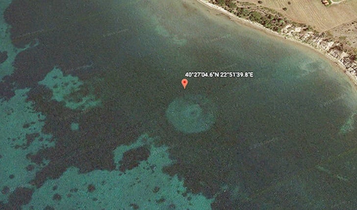
In 2018, a Youtuber named The Hidden Underbelly 2.0 posted a video showing a strange object, thought to be around 220 feet long, off the coast of Michaniona, Thessaloniki, Greece. A large circle, filled with smaller circles towards its center, nobody could figure out what it was.
Suggestions in the comments on the video ranged from the object being a former lighthouse, volcanic crater, and even an alien spacecraft. One user wrote: “That’s one unusual alien spacecraft. I’ve never seen anything like it. Is this Salarian or Asari?”
Blood-red lake, Iraq
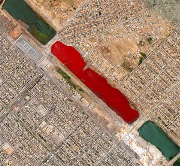
On the outskirts of Sadr City in Iraq there is a blood-red lake. This is part of a stretch of water called Lago Vermelho. The lake runs through the city and is separated by sections of concrete and crossings. It is within one of the central panels of water that the bright red color could be seen, giving the appearance of blood.
Speculation as to what may have caused the red coloring was rife at the time, with some suggesting the lake was close to a slaughter house and the coloration was the result of dead animals being dumped there.
Others put forward the more sensible suggestion that the lake was near a sewage treatment plant, or perhaps water treatment was the cause of the color. The strange lake has since returned to its normal color on Google Earth.
Military plane graveyard, US
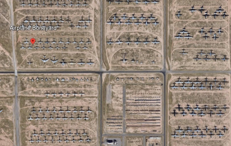
The Davis Monthan Air Force Base in Tucson, Arizona is a large base where out-of-service and retired military planes are abandoned. Known as “the boneyard,” this 2,600-acre steel cemetery is off limits to the public, but Google Earth offers people a high-resolution view of what’s inside. That just happens to be almost every plane the US military has used since World War II.
A billionaire’s name in the sand
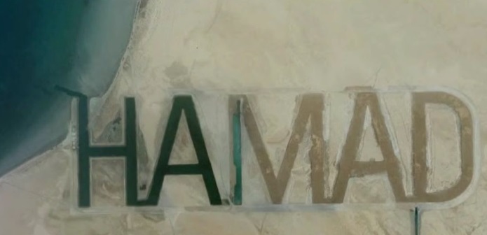
Hamad bin Hamdan al Nahyan, a billionaire Sheikh and a member of Abu Dhabi’s ruling family, had his name etched into the sand on the island of al Futaisi, which he owns. The name is written half a mile in height and two miles in length. It is allegedly visible from space. Whereas the sea would typically wash away any markings in the sand, these letters are so huge they form waterways that fill with the tides but do not vanish.
Swastika Symbols in Kazakhstan
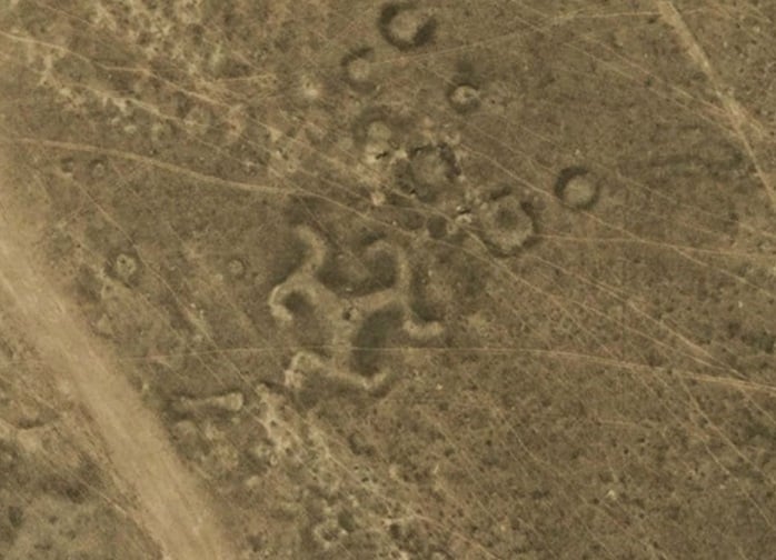
Archaeologists and scientists found more than fifty geoglyphs (large scale image made on the ground) across northern Kazakhstan in Central Asia, including a swastika-like shape. The swastika symbol was constructed using wood, but many other geoglyphs in the region were made of earthen mounds.
It is claimed that the enormous ground images date back two thousand years ago. This was a time when the swastika was in common use across Europe and Asia and represented unity and wholeness.
Jordan’s Earthly Wheels
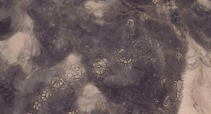
Google Earth has also spotted some ancient artwork carved into the surface of Jordan’s Azraq Oasis, including wheel-shaped geometric structures that arguably date back to around 6000 BC. Some of the designs are positioned in such a way that they align with sunrise on the winter solstice.
Google Earth has also been the harbinger of scientific research, with this discovery aiding scientists with the Aerial Photographic Archive for Archaeology in the Middle East (APAAME) in their investigations into wheel structures. The wheels vary in design, with some showing spokes that radiate from the center. Others have just one or two bars rather than spokes.
A pyramid?
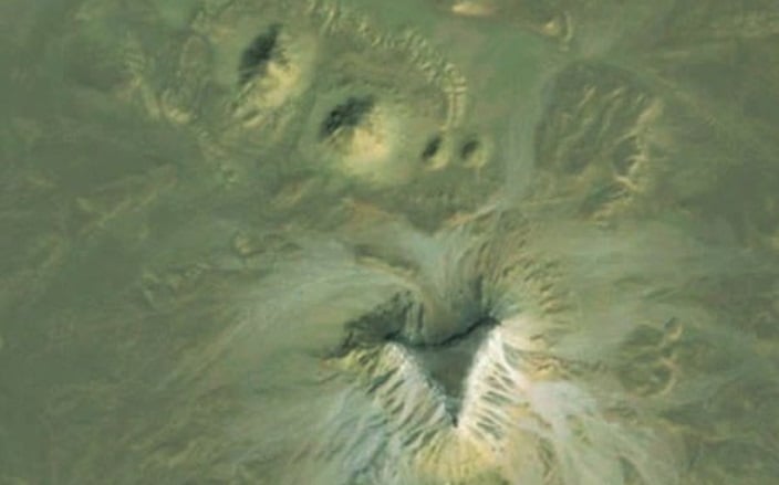
This Google Earth image shows a seemingly sunken sand patch which some believe could be an unexcavated pyramid. A lot of strange things have been seen in Egypt using Google Earth over the past six years, but there is debate as to whether the anomalies detected are natural or man-made structures.
An Enormous Religious Symbol in Kazakhstan
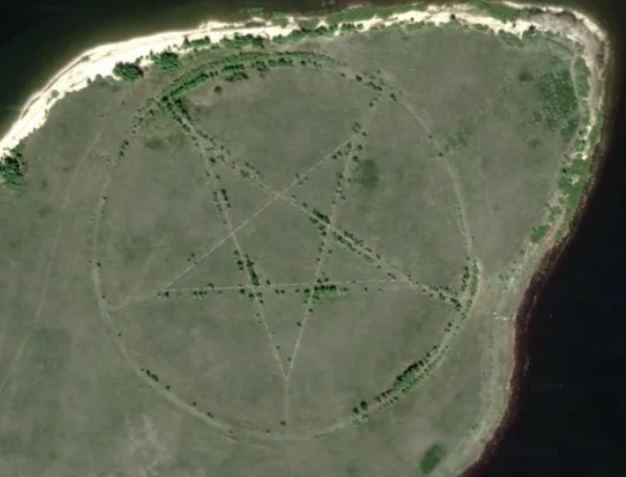
Another strange symbol on the steppes of Central Asia in Kazakhstan, this huge pentagram, which measures around 1,200 feet in diameter, has been carved into the surface of the earth. The five-pronged, encircled star, found on the southern shore of the Upper Tobol Reservoir, shows up very clearly on Google Maps, the online version of the more detailed Google Earth.
Many online comments have linked the symbol with devil worship, unfriendly religious groups, or demons. However, in reality, the pentagram is the outline of a park made in the shape of a star, which is marked by roadways that are now lined with trees.
A Giant Spiral
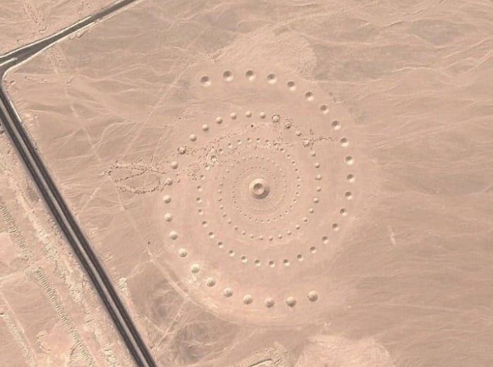
Located in the Egyptian desert not far from the coast of the Red Sea, this spiral design is an art installation called Desert Breath. In March 2007, Danae Stratou, Alexandra Stratou, and Stella Constantinides created the one million square foot artwork installment, which was designed to celebrate “the desert state of mind, a landscape of the mind,” as the artists state on their website.
Scientology return pad?
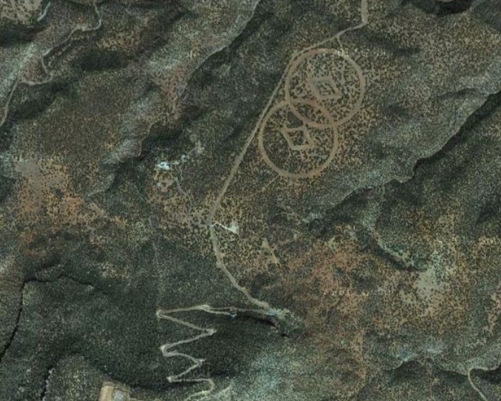
Located on the desert floor near Mesa Huerfanita, New Mexico, these two large diamonds encased in overlapping circles are claimed to be a hidden bunker belonging to the Church of Scientology. The organization’s website makes mention of a “supreme being and a spiritual universe,” and these symbols on the desert floor are reportedly there to help guide scientologists who return to earth after fleeing a planetary “Armageddon,” as reported by the Daily Mail.
See all the latest news from Greece and the world at Greekreporter.com. Contact our newsroom to report an update or send your story, photos and videos. Follow GR on Google News and subscribe here to our daily email!
