

New archaeological research reveals that the sea off northwestern Australia once had islands and a massive landmass. This area was so large it could support around half a million people, as reported in a study published in Quaternary Science Review.
The study maps a world that appeared and then disappeared as sea levels changed over the past seventy thousand years. People are believed to have migrated to this part of the world between forty-five thousand to sixty-five thousand years ago.
The area was part of a paleocontinent called Sahul, connecting Australia to New Guinea. The submersion of this land might have led to significant cultural and population changes in northern Australia.
“It’s this incredible landscape that we really don’t have any analogy for in Australia today,” Kasih Norman, the lead author and a research fellow at Griffith University, reported to Cosmos.
A 3D map of the undersea area that had emerged and then disappeared
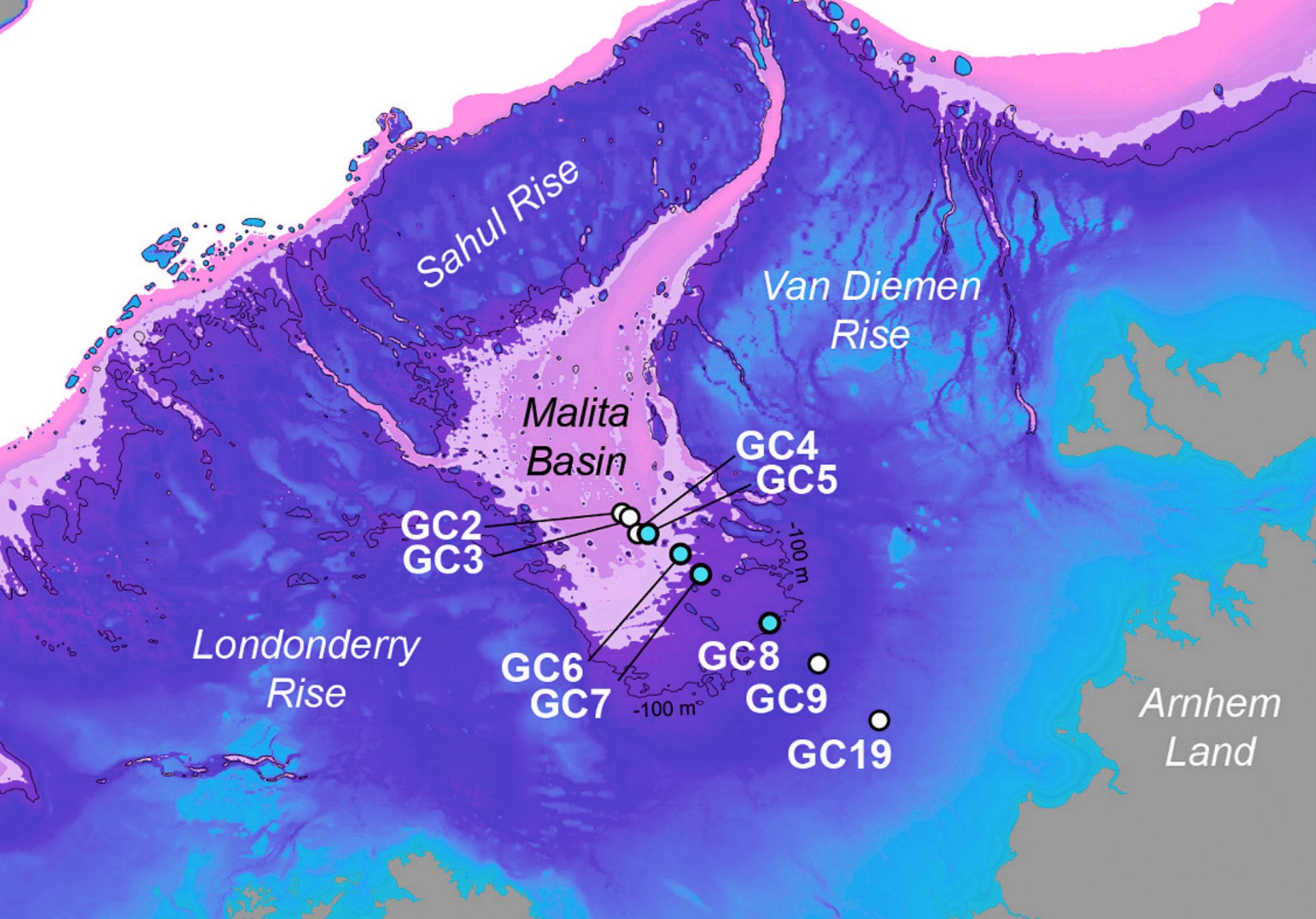
The scientists created a 3D map of the undersea region by using bathymetric data from Geoscience Australia. This data is gathered by ships during marine surveys, employing sonar and other mapping technologies, as reported by Cosmos.
“We can see huge ravines; massive river channels that are still preserved on the ocean floor; we can see where lakes might have been,” said Norman. “Then we can start to do things like project past sea levels onto that three-dimensional landscape surface.”
Sea level rise drowned a vast habitable area of north-western Australia driving long-term cultural change pic.twitter.com/7ZpYwOh6YO
— Odyssey to the Far East (@motherlander) December 19, 2023
Using this data, Norman and her colleagues were able to visualize how the area appeared at various times in history. They determined that a large group of islands existed, extending towards Indonesia, between sixty-one thousand to seventy thousand years ago. This archipelago remained stable for a period of nine thousand years, as explained by Norman.
The archipelago linked today’s Kimberley in northwestern Australia with Arnhem Land at the top of the Northern Territory. During a period known to archaeologists as Marine Isotope Stage 3, sea levels rose and fluctuated significantly, as reported by Cosmos.
The ancient landmass that disappeared could have had 50,000 to 500,000 people
Demographic experts on the research team estimate that at various times, the archipelago and landmass could have sustained a population ranging from fifty thousand to five hundred thousand people.
However, this expansive landscape faced a dramatic decline as the ice melted and sea levels rose, occurring between nine thousand to fourteen thousand years ago. The most rapid changes took place during a period known as Meltwater Pulse A.
According to Norman, a little over sixty-two thousand miles “of that northwest shelf region went underwater in four hundred years.” Apparently, the amount of sea level rise increased from about three feet to around thirteen or more feet per century.
“People that were living in this region would have seen the landscape going underwater almost before their eyes,” Norman added. “It would have changed incredibly dramatically in the space of their lifespan.”
See all the latest news from Greece and the world at Greekreporter.com. Contact our newsroom to report an update or send your story, photos and videos. Follow GR on Google News and subscribe here to our daily email!
