

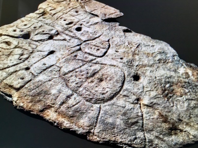
The Saint-Belec Slab, a Bronze Age stone slab of rock carved out nearly 4,000 years ago, representing Europe’s earliest-known 3-D map, was recently rediscovered in a cellar in western Brittany.
The two-meter by 1.5-meter (5 foot by 6.5 foot) slab, which was first uncovered in 1900, was found once again in a cellar in a castle in France in 2014.
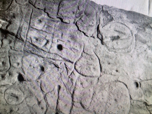
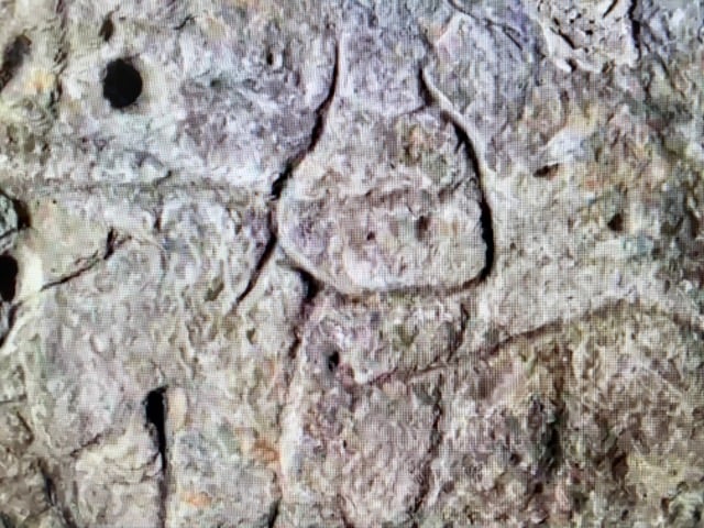
Archaeologists who have studied patterns that were so painstakingly engraved 4,000 years ago on stone say they believe the markings represent an area in western Brittany.
First unearthed in Brittany in 1900, the piece of rock, known as the “Saint-Bélec Slab,” is believed to date from the early Bronze Age, between 1900 BC and 1650 BC.
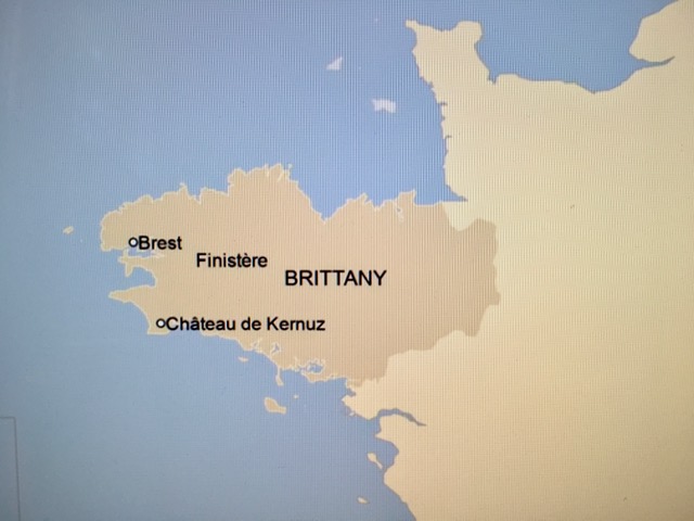
The rock was found initially during archaeological digs in a prehistoric burial ground in Finistère (“Land’s End,)” the westernmost tip of Brittany, by local archaeologist Paul du Chatellier.
Incredibly, somehow the slab was forgotten for over a century, while it was kept for decades under a moat at du Chatellier’s home, the Château de Kernuz.
Fortunately, researchers who were looking for the slab rediscovered it in a cellar in 2014.
After analyzing marks and engravings on the stone, the researchers suspected it could be a map of western Brittany itself. They say that the “presence of repeated motifs joined by lines” on the rock suggested it showed an area of Finistère, according to a study published in the Bulletin of the French Prehistoric Society.
Bronze Age stone slab represents river network in Brittany
They state that they believe the carvings so laboriously made in the rock are a 3D representation of the valley of the River Odet; several lines appear to show the area’s river network.
Modern technology confirms that the landmarks represented on the slab are 80% accurate, depicting the area around an 18 mile-long stretch of the Odet River.
Dr.Clément Nicolas from Bournemouth University, one of the study’s authors, told the BBC “This is probably the oldest map of a territory that has been identified.
“There are several such maps carved in stone all over the world. Generally, they are just interpretations. But this is the first time a map has depicted an area on a specific scale,” Nicolas explained.
He stated that, in his opinion, the map “was probably a way to affirm the ownership of the territory by a small prince or king at the time.
“We tend to underestimate the geographical knowledge of past societies. This slab is important as it highlights this cartographical knowledge,” Nicolas noted.
See all the latest news from Greece and the world at Greekreporter.com. Contact our newsroom to report an update or send your story, photos and videos. Follow GR on Google News and subscribe here to our daily email!
