


Ancient Peru geoglyphs in the Chillón Valley near Lima are offering new clues about how early communities may have used and organized the landscape thousands of years ago.
A new study suggests that some of these large ground markings were placed in ways that cannot be fully explained by chance, although researchers caution that the evidence does not yet prove a direct connection to ancient roads or ritual practices.
The research, led by Christian Mesía-Montenegro and published in PLOS One, examined geoglyphs in two areas of Peru’s middle Chillón Valley known as Huarabí and Pichausa.
The study combined field surveys, drone mapping, and statistical modeling to investigate whether the location of the geoglyphs was related to nearby routes used for movement through the rugged valley landscape.
Geoglyphs are large designs or markings created on the ground. Peru is best known for the famous Nazca Lines, but similar features exist in several other parts of the country. Many remain poorly studied compared with the better-known geoglyphs of southern Peru.
Researchers examine overlooked geoglyph sites
The geoglyphs documented at Huarabí and Pichausa differ from many of Peru’s famous geometric and animal-shaped figures. Instead, they consist of irregular line patterns located within quebradas, or dry valleys, that cut through the landscape.
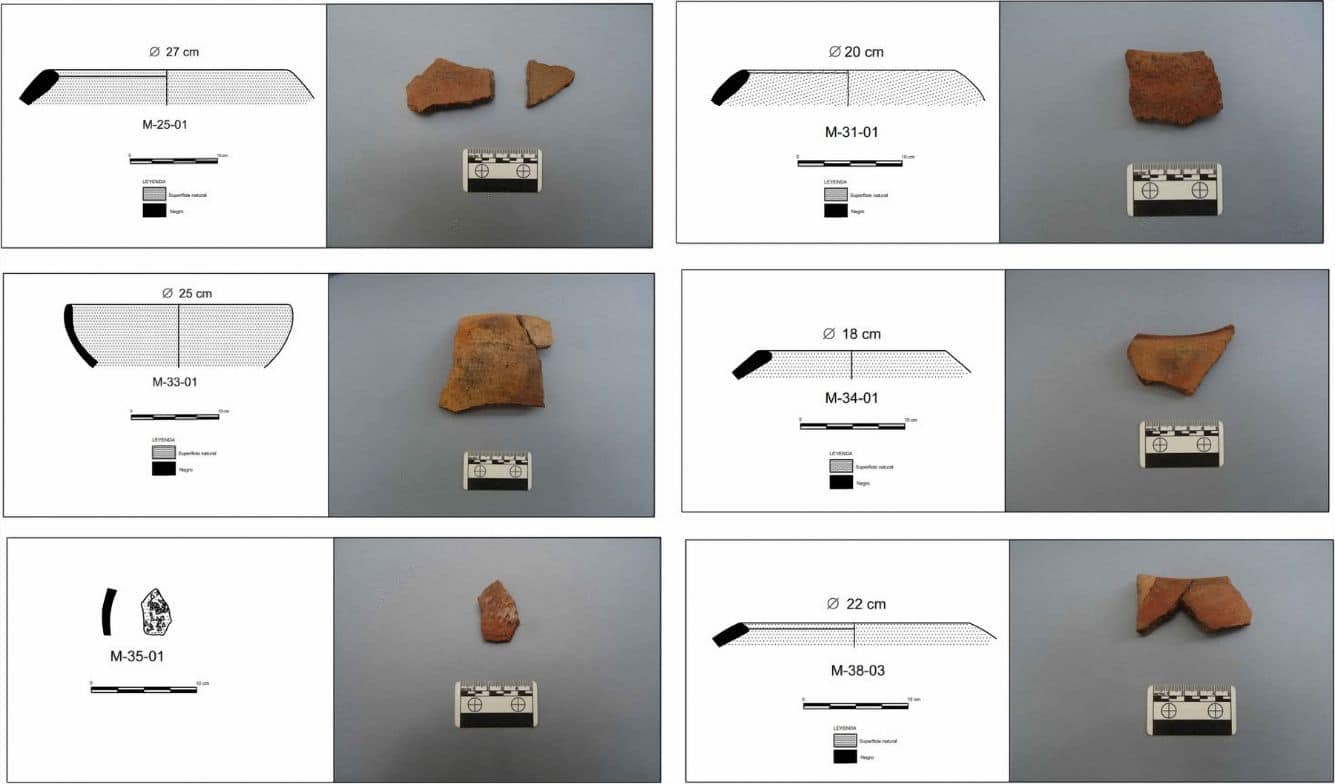
Researchers conducted systematic surveys between 2021 and 2022 and recorded geoglyphs across multiple sectors of the Chillón Valley. The study focused on four irregular geoglyph groups, two at Huarabí and two at Pichausa. It also examined six locations near Huarabí where surface pottery fragments from the Formative Period were found.
Ancient geoglyphs in Peru's Chillón Valley are shedding new light on how early communities may have used and organized the landscape. pic.twitter.com/HkbOKhx2Ic
— Tom Marvolo Riddle (@tom_riddle2025) June 9, 2026
The Formative Period on Peru’s central coast spans a time when early ceremonial centers, agriculture, and ceramic traditions were developing. Nearby archaeological sites include several U-shaped ceremonial structures that played important roles in the region’s ancient communities.
Statistical tests challenge simple explanations
Rather than simply measuring distances between geoglyphs and routes, researchers used Monte Carlo simulations. This method allowed them to compare the actual placement of the geoglyphs with thousands of hypothetical random placements across the landscape. The results showed a contrast between the two study areas.
At Huarabí, the geoglyphs differed from what would be expected under the researchers’ chance-placement models. At Pichausa, however, the geoglyphs generally matched patterns that could be produced through random placement. The findings suggest that Huarabí may have followed a different spatial logic than Pichausa.
Even so, the researchers emphasize that the results do not automatically mean the geoglyphs were intentionally built beside roads or movement corridors.
Instead, the analysis shows only that the Huarabí geoglyphs were less easily reproduced by the statistical models used in the study. Other factors, including terrain, visibility, erosion, and landscape features, could also have influenced where the geoglyphs were created.
Pottery provides limited clues about age
One of the study’s most important findings concerns chronology. At Huarabí, researchers identified diagnostic pottery fragments that resemble ceramics from the Formative Period. The pottery suggests human activity occurred near the geoglyphs during that era.
However, the artifacts were found on the surface rather than in sealed archaeological deposits. As a result, they cannot directly date the construction of the geoglyphs.
No comparable pottery evidence was discovered at Pichausa, making the age of those geoglyphs even less certain. Because of these limitations, the researchers avoid claiming that the geoglyphs themselves were definitely built during the Formative Period.
Questions remain about ancient landscape use
Researchers conclude that Huarabí should currently be viewed as a geoglyph locality associated with nearby Formative-period activity rather than as a securely dated Formative geoglyph complex.
They argue that future work should focus on obtaining direct dates, studying visibility across the landscape, and developing more detailed models of how ancient people moved through the valley.
While the findings do not solve the mystery of the Chillón Valley geoglyphs, they provide one of the most detailed examinations to date of how these large ground markings may have related to movement, settlement, and ritual activity in ancient Peru.
See all the latest news from Greece and the world at Greekreporter.com. Contact our newsroom to report an update or send your story, photos and videos. Follow GR on Google News and subscribe here to our daily email!

