

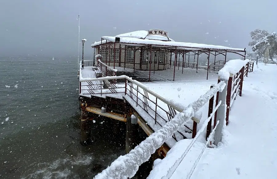
Storm “Avgi” (Dawn) has struck Greece since Sunday with heavy snowfall and significant temperature drops expected to last until Wednesday, reported the National Meteorological Service on Monday.
The first snow has already appeared in the mountains of Evia and Crete.
Snowfall is forecasted from Thessaly in Central Greece and on southward even in lower-altitude areas. High pressures in the Northwestern Balkans, coupled with low pressures in the Eastern Mediterranean are causing stormy winds and further temperature drops along with locally heavy rainfall in southern areas.
In Attica, snowfall is expected mainly in mountainous and semi-mountainous areas, particularly in the north, spreading to lower altitudes from the evening hours of Monday. Intensity will increase Tuesday morning, mainly in eastern, northern, and western areas but gradually weaken overnight.
Furthermore, on Tuesday, northerly winds in the Aegean Sea will reach speeds of 9 Beaufort and locally reaching 10 Beaufort. This will be accompanied by heavy rain and thunderstorms, which will gradually subside from Wednesday evening onwards.
The state mechanism has been put on standby, and the Risk Assessment Committee created a few ago as a result of legislation restructuring the civil protection service in December, held its second session ahead of a cold snap.
The Committee aims to monitor all dangerous natural phenomena and predict their possible impact on infrastructure, health and safety, decide on the appropriate alert level for state mechanisms and propose precautionary measures to protect life and property.
The meeting focused on organizational issues and coordination, as well as the upcoming bad weather in Greece on Saturday and Sunday.
Weather warnings in Greece for “Avgi” storm
As of January 29th, officials have issued the following weather warnings across Greece:
Orange heavy snowfall warnings (the middle level on a three-tier scale): Crete, Cyclades Islands, East Sterea and Evia, and the North East Aegean Islands regions.
Orange heavy rainfall warnings: Crete, Cyclades Islands, and the North East Aegean Islands regions.
Orange thunderstorm warnings: Crete, Cyclades Islands, East Sterea and Evia, and the North East Aegean Islands regions.
Orange strong wind warnings: the North East Aegean islands Region.
Yellow snowfall warnings: Attica, Eastern Peloponnese, and Thessaly regions.
Yellow thunderstorm warnings: Attica Region.
The disruptive weather will likely cause some delays and cancellations at airports in affected regions. Authorities may temporarily suspend port operations if strong winds trigger hazardous sea conditions, impacting freight and passenger maritime traffic.
Flooding or snow could block regional rail lines; freight and passenger train delays and cancellations are possible in areas that see heavy rainfall and potential track blockages.
See all the latest news from Greece and the world at Greekreporter.com. Contact our newsroom to report an update or send your story, photos and videos. Follow GR on Google News and subscribe here to our daily email!
