

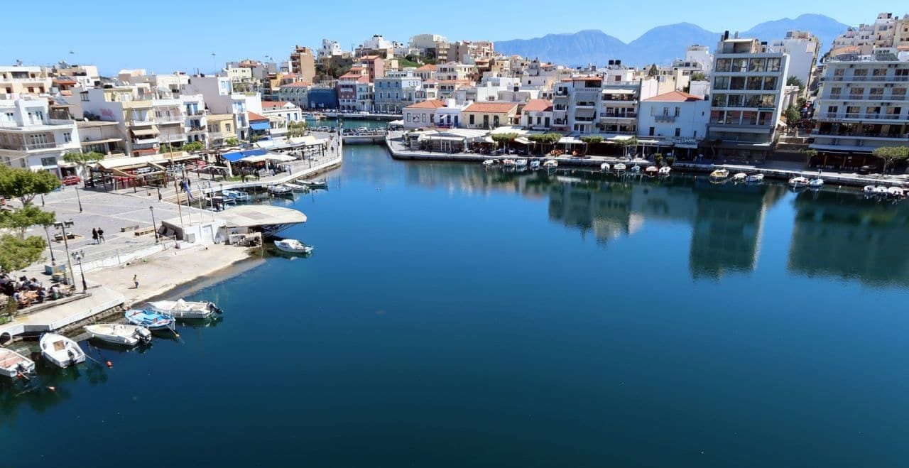
Lake Voulismeni (Greek: Λίμνη Βουλισμένη) is an ancient lake located in the center of the city of Agios Nikolaos on the Greek island of Crete.
By: Tony Cross
The town of Agios Nikolaos, nestled on the shores of the Gulf of Mirabello on the eastern end of Crete, has many treasures for the visitor to discover.
These include the 13th century frescoes in the church of Panagia Kera, for example, the exposed remains of a Roman villa in the middle of the town, and the beauty and pain of the island fortress and former leper colony of Spinalonga. Close to the port, however, lies one of the greatest treasures of the town; Lake Voulismeni.
Known by the locals simply as “the lake” this nearly circular pool is reputed to have been the bathing place of the goddesses Artemis and Athena. It’s not difficult to see why they would choose such a beautiful and enchanting spot in which to bathe.
The mysteries hidden in the lake of Agios Nikolaos
The locals claim that it’s bottomless and is connected to the deeper regions of the underworld. They will also tell you that it’s an ancient volcanic vent and that it’s connected by deep underground channels with the active volcano at Santorini.
None of that is true, of course, but the real story of the lake is no less impressive. It is much deeper than any part of the adjacent sea for many kilometers offshore, for example.
The first recorded measurement of the lake’s depth was made in November 1851 when the British naval surveyor Captain Thomas Spratt determined that it was 210 feet deep at the center (64 meters).
An early geologist, Spratt, also realized that it could not be volcanic in origin because of the complete absence of igneous rocks in the area.
If it’s not volcanic then how did it form?
We know today that the lake fills a deep funnel-shaped sinkhole, formed when an ancient cave grew so large that it could no longer support the weight of rock above it.
The collapse would have been sudden and catastrophic, but it occurred long before humans arrived on the island. Looking around the lake area today, it’s still possible to see the wide bowl that was created as the cave collapsed.
Captain Spratt also noted that the lake was ‘brackish’ (freshwater but polluted with enough seawater to make it undrinkable) and overflowed via a small stream into the nearby sea. He assumed that the lake was being fed with fresh water by an underground stream.
Why is it now connected to the sea by a man-made channel?
When the cave collapsed to form the sinkhole the underground stream would have filled it with fresh water until it overflowed into the sea. This is the lake that Captain Spratt saw in November 1851.
By the late 1860’s, however, the lake had become stagnant and smelly, and it was known locally as Vromolimni, or the stinky lake, in other words. The most likely cause of this stagnation was a massive earthquake that devastated north-eastern Crete in the early morning of October 12, 1856.
This earthquake was felt right across the eastern Mediterranean and caused damage as far away as Cairo in Egypt. It’s likely that the earthquake collapsed and blocked the underground stream that fed the lake, and that’s why it became stagnant.
It was soon realized that the best way to deal with the stagnant smell would be to connect the lake to the nearby sea. The higher-density seawater would flush out the stagnant water and clean the lake.
The first channel to the sea was cut in 1867 by order of Kostas Adosides Pasha, the Ottoman governor at the time. Unfortunately, this roughly dug channel collapsed several times in the following years and had to be cleaned out each time to stop the lake from stagnating again.
In the early years of the 20th century, the channel was widened and deepened by the French army, which lined the walls with stone to prevent further collapse. This is the channel we see today.
In 2000, the University of Athens commissioned a detailed underwater survey of the lake, the first ever conducted. This survey found the depth at the center to be only 48.8 meters (160 feet).
How has the lake depth been reduced in only 149 years?
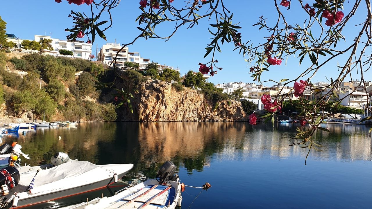
The cliff in the western corner of the lake shows clear signs of a fairly recent collapse. The underwater survey also shows good evidence of collapsed material flowing into the lake. The cause of this collapse is almost certainly the 1856 earthquake. The scar left by this collapse can be clearly seen today.
Many divers have descended to the flat bottom of the lake in recent years even though in 1967, the famous marine explorer Jacques Cousteau thought it too dangerous to attempt.
The divers found a layer of silt and mud on the bottom that was easily disturbed by their fins, but apart from the wooden ribs of an old fishing boat that sank some years ago, the bottom is completely featureless.
Where are the German tanks?
Near the close of World War II as the German army was preparing to evacuate the town, they dumped everything they couldn’t carry into the lake.
Eyewitnesses reported large vehicles, described as tanks by some, being pushed into the lake. In addition, a water tanker making a delivery above the lake in 1975 suffered a handbrake failure and rolled into the lake.
Where are these vehicles? There is no evidence of them on the bottom of the lake today. It’s most likely that they sank into the layer of silt and mud that blankets the bottom. That means that this silt layer must be very thick.
Much of it will be the lighter material that slid into the lake and settled out after the 1856 cliff collapse. It would be fascinating were an exploration mounted to detect the metals of these vehicles through the thick silt and verify that they really are down there.
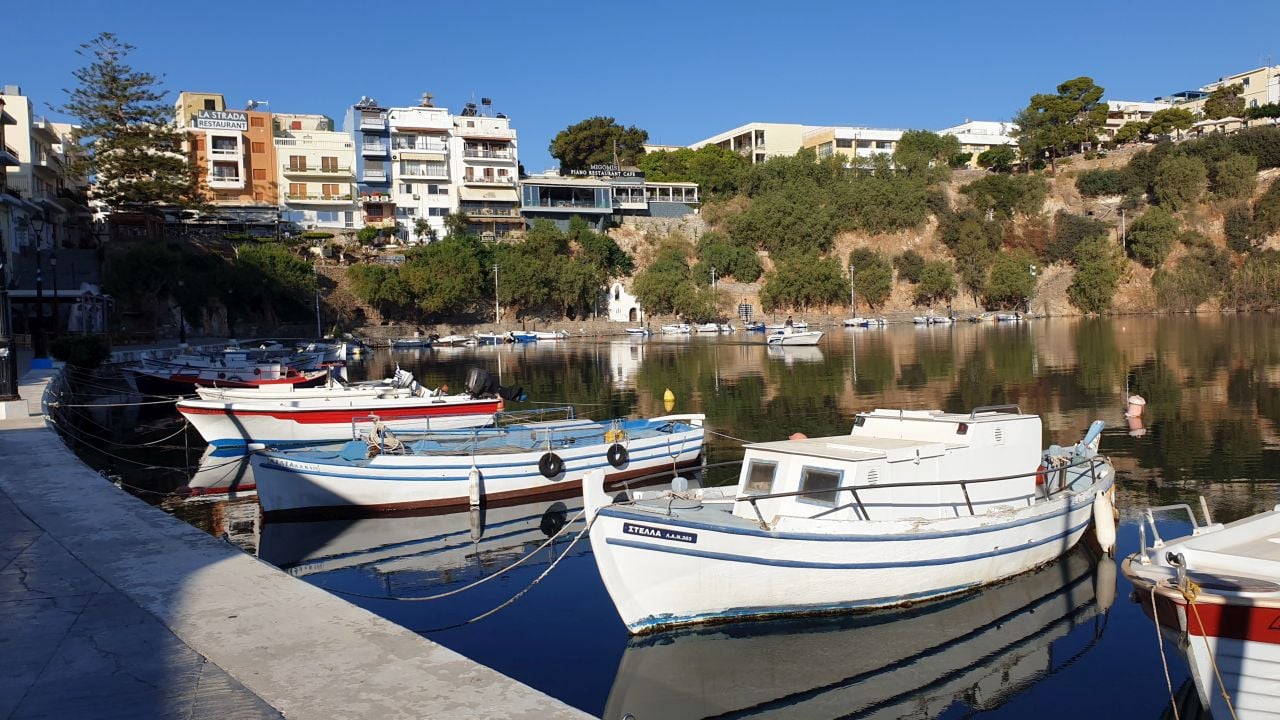
Most visitors who see the lake today are content to view the peaceful and calming lake from the comfort of one of the many bars and tavernas that surround it.
A scenic walkway that runs up the area of the cliff collapse in 1856 takes the visitor to the top of the cliff, where stunning views across the lake and town can be found.
The lake is not a volcano, nor is it bottomless, but it’s full of mystery nonetheless.
See all the latest news from Greece and the world at Greekreporter.com. Contact our newsroom to report an update or send your story, photos and videos. Follow GR on Google News and subscribe here to our daily email!
