



Santorini’s towering cliffs, flooded caldera and black volcanic islets, all shaped by volcanoes, form one of the most recognizable settings in Greece. Yet the island seen today represents only the latest stage in a geological history stretching back hundreds of thousands of years.
A six-minute animation illustrates that long transformation, showing how repeated eruptions, earthquakes and collapses gradually reshaped the island complex. His Santorini Volcano History project draws on scientific research, historical material and geological reconstructions to present how the area changed over time.
The animation offers a clear visual summary of a much more complex geological story. Santorini did not emerge from a single catastrophic event. Instead, a series of eruptive centers developed, disappeared and re-emerged across the region, leaving behind layers that geologists can still study in the cliffs today.
How volcanoes shaped Santorini over hundreds of thousands of years
Santorini lies within the active South Aegean volcanic arc, a zone formed by the movement of tectonic plates beneath the eastern Mediterranean.
Volcanic activity in the area began hundreds of thousands of years ago. Over time, lava flows, ash deposits and major eruptions repeatedly changed the shape of the islands.
Scientists have found evidence of numerous eruptive centers and at least 12 major explosive episodes in the geological record. Each phase added new material, while later collapses removed or submerged parts of earlier formations.
The result was a constantly changing group of islands rather than a single permanent landmass.
Korakakis’ reconstruction helps visualize this process by showing new volcanic centers appearing as parts of the land changed over long periods. A nineteenth-century map showing the geological evolution of the island group also partly inspired the animation.
Santorini’s caldera formed through repeated collapses
The immense sea-filled basin at the center of Santorini is its defining geological feature, but no single event created it.
Research shows that several major caldera-forming events took place during the region’s history. Later collapses overlapped older structures and helped create the complex shape visible today.
The cliffs surrounding the basin still reveal this repeated cycle of construction and destruction. Layers of lava, ash and other material show how one phase of activity followed another.
What now appears as a dramatic natural amphitheater developed through several major events separated by long periods of time.
The Minoan eruption reshaped the island

The best-known event took place during the Late Bronze Age, roughly 3,600 years ago.
The so-called Minoan eruption ranks among the largest eruptions of the Holocene. The eruption sent enormous quantities of ash and volcanic material into the atmosphere, while pyroclastic flows spread outward and reached the surrounding sea.
The event caused further collapse and played a major role in shaping the modern island group.
However, the Minoan eruption did not create the caldera from scratch. Geological evidence shows that a large depression already existed before the Bronze Age disaster, meaning earlier eruptions had already changed the region.
The eruption also buried the prehistoric settlement of Akrotiri beneath thick layers of ash and debris. This natural cover helped preserve buildings, streets and artworks that later gave archaeologists a rare view of Aegean Bronze Age life.
After the collapse, seawater filled much of the basin and helped create the distinctive crescent-shaped form associated with Santorini today.
New land rose from the sea
Santorini’s geological history did not end with the Bronze Age catastrophe.
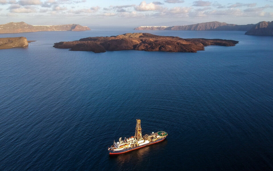
Activity later resumed inside the flooded basin, where lava gradually formed the islands of Palea Kameni and Nea Kameni.
These dark formations rank among the youngest parts of the wider volcanic system. Successive eruptions added fresh layers of lava over the centuries, with the most recent eruption taking place in 1950.
Their presence is a clear reminder that the region remains geologically active.
From Fira, Imerovigli and Oia, visitors can see this history spread out before them. Ancient cliffs mark earlier cycles of destruction, while the younger Kameni islands rise from the sea below.
Santorini’s volcanoes tell a geological story still in progress
Korakakis’ animation works especially well because it compresses an enormous span of geological time into a few minutes.
Rather than presenting Santorini as a static island, it shows a place repeatedly built, fractured and reshaped by forces beneath the Aegean.
That history also explains why scientists continue to study the region closely. Its exposed cliffs contain evidence of many eruptive phases, while the younger formations inside the basin show that activity continued long after Santorini took on much of its modern form.
Santorini’s beauty is therefore inseparable from the forces that created it.
What appears today as one of Greece’s most famous destinations is, in geological terms, only the current stage of a transformation that began hundreds of thousands of years ago and may not yet be complete.
See all the latest news from Greece and the world at Greekreporter.com. Contact our newsroom to report an update or send your story, photos and videos. Follow GR on Google News and subscribe here to our daily email!

